Do you ever wonder how some guys kill mature bucks year-after-year while other hunters go several seasons in a row without killing a good buck? Hunters that kill giant bucks every year are achieving a high level of success because they hunt bucks close to where they spend their daytime hours. One of the best ways to a find mature bucks’ daytime bedding is by using an aerial map. Here’s how:
To find mature bucks you first want to identify where roads, houses, and other areas of human activity is likely to be. The next step in your search is identifying areas that provide cover for deer to hide that is furthest away from areas of human activity. Once you focus your search on these areas you will then be able to key in on habitat features, like pinch points, where mature bucks will likely travel and spend the majority of their time.
One of the best ways to find mature buck is by bringing him to you instead of you going to him. If you are able to manipulate the habitat on the land you hunt, you can encourage bucks to bed on your property by creating the security cover they need. Learn how to set up a property for deer hunting.
If you can’t create your own daytime bedding habitat on the lands that you hunt, then you have to seek these places out. Without several hundred or several thousand acres to hunt, that can be a somewhat challenging task if you need to ask for permission from a bunch of landowners. It can be done but it’s not easy. On the flip side, if you do have the ability to cover a lot of ground, the rest of this article will lay out a process of elimination to help you increase your odds of locating mature bucks on an aerial map.
Learn the neighborhood
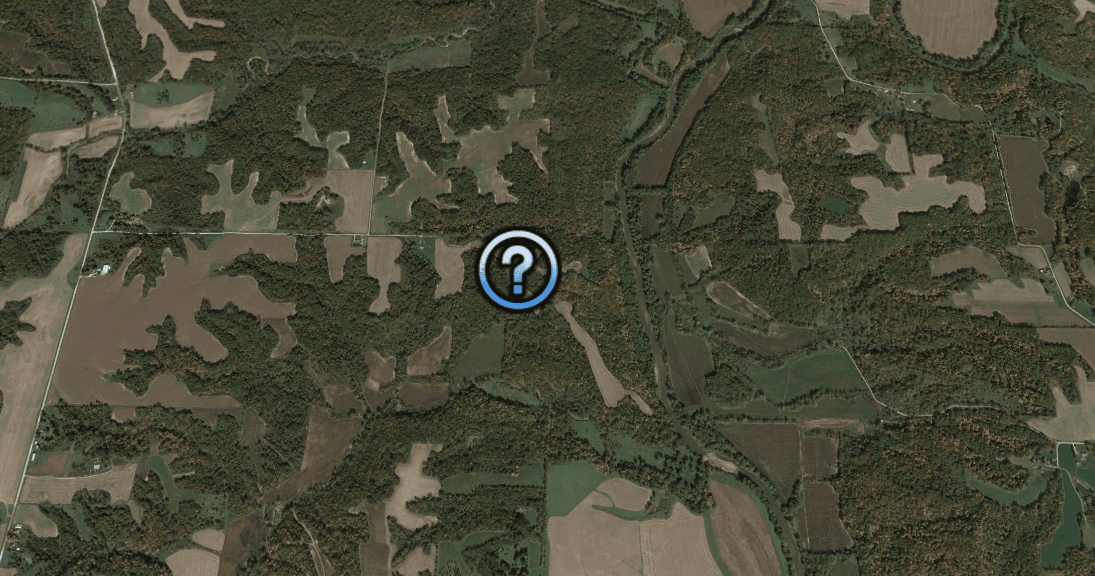
Whether I’m looking for mature bucks for myself or laying out a hunting plan for a client’s property, the first thing I do is zoom out on an aerial map and get an idea what the neighborhood has to offer deer. Mature bucks have a large home range so I will zoom out at least 1,000 acres, but usually I’m looking at several square miles.
Look for areas that have large feeding fields, or any other food sources that might act as primary feeding areas. I’m also looking for terrain features, differences in habitat types, rivers, lakes, ponds, pinch points, field corners, funnels, etc. Pay close attention to anything that will help you form an understanding of what that area has to offer for deer and access. After I study an arial for 10 minutes or so, I usually have a good idea what an area has to offer and how I want to approach hunting it.
Identify areas of human intrusion
The next step in the process for finding mature bucks with an aerial map is zooming in on spots that are believed to be daytime buck bedding locations. You might be asking how I identify these spots on a map.
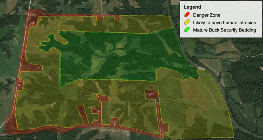
Start by marking off zones where human intrusion is likely to happen. If there are houses, roads, known hunting pressure areas, or anything else indicating human intrusion, then mark off those areas as danger zones.
Once you mark off all the danger zones on a map, you should be able to narrow down on the spots that mature bucks call home. These are the spots you should start looking for them. Don’t overlook small patches of cover that most hunters wouldn’t even consider hunting. That’s exactly the kind of spot that a mature buck will find and elude hunters for years without being killed.
Confirming where areas of human intrusion are and looking for mature bucks outside those danger zones is a key step in this process for consistently finding them. There are always exceptions to the rule. You can still find mature bucks in a danger zone where human intrusion is. However, the process laid out in this article is describing how to play the odds of finding mature bucks more often. Additionally, this process is also intended to help you find mature bucks quickly and cut down on the amount of scouting time that you need to do in the field.
Overlay a topo map on your aerial
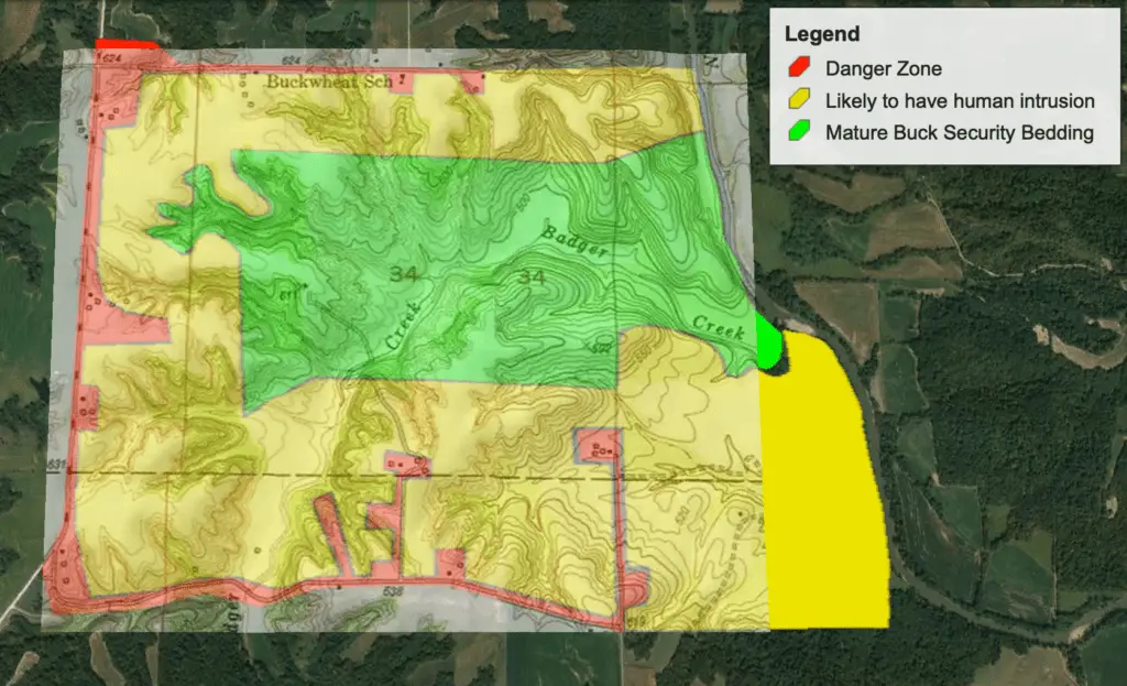
Once you have a spot identified where you think a mature buck might be living, the next step is to take a closer look at that specific spot. Does that spot have a monoculture of habitat, or are there different habitat types that come together to create an edge? When you have a topographical overlay on an aerial map it will help point out habitat features that might not be easily recognizable. The contours of a topo map will help you identify ridge tops, valleys, swamps, streams, saddles, pinch points, etc. Understanding all the features and habitat in a specific spot will clue you in on specific locations for where you should setup your deer stand.
Identify pinch points and transition areas
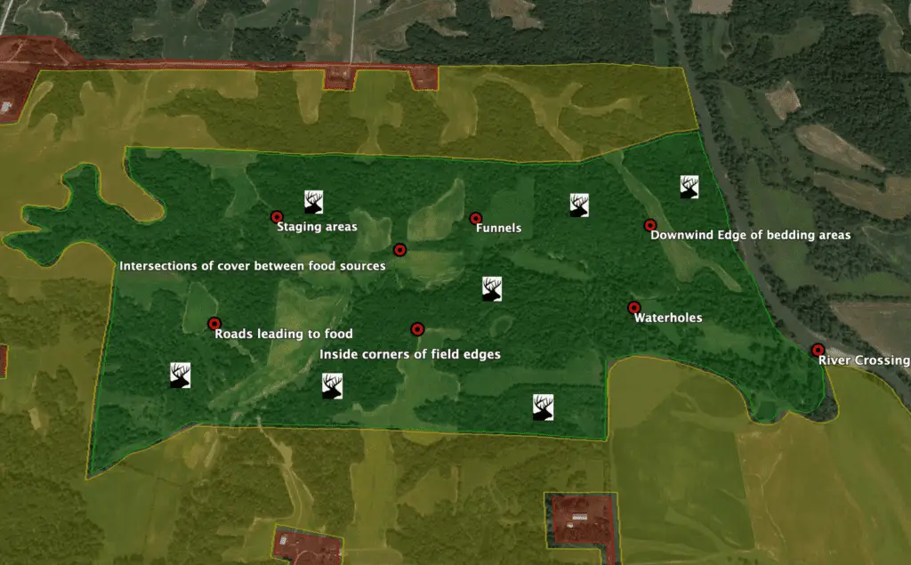
Once you are close to a mature buck’s daytime bedding area, the next step is finding spots where he will walk within shooting range from your tree stand. Ideally, these spots will also be locations where you can hunt without a buck ever hearing, seeing, or smelling you. You also need to keep deer from knowing when you are using entry and exit routes to your tree stand locations.
Here are a few pinch points and transition areas to look for when selecting tree stand sites:
- Funnels
- Fence crossings
- Creek or River crossings
- Inside corners of a field
- Saddles
- Fence rows
- Ends of a drainage ditch
- Old logging Roads
Confirm in the field
After you have completed your aerial search for big bucks, you are now ready to confirm your theory and prove that you found an area where a mature buck lives. You might be asking how to approach this. Here’s how:
If hunting season is already in progress, the last thing you want to do is go walking around looking for mature buck sign and spreading your human scent everywhere. Doing that would hurt your chances of killing a mature buck before you even started hunting. The best thing you can do is hunt and scout in the same trip. You might also consider hanging a trail camera the same day you hunt so that you can scout the area while you are away.
The best way to scout for mature bucks is with trail cameras. A camera can hunt for you while you’re away. The intel from a trail cam can help you decide where to spend your time in the stand to offer the best opportunity at a mature buck. Try hanging several cameras in different locations to improve your odds of finding where mature bucks are hiding during the day.
The best time to do boots-on-the-ground scouting is when hunting season ends. This is a great time of year to see all the deer sign from the previous season. Winter scouting will also make it easier for you to move throughout a property and identify deer sign easier since there won’t be a bunch of vegetation in your way as you walk and look around.
Conclusion
Aerial maps can help you find mature bucks and be more efficient at it. Mature bucks prioritize security cover above everything else, so use the process of elimination described in this article to help you find the spots where bucks can get away from human activity. Once you have those spots narrowed down, zoom in on the map and take a closer look to see what those spots have to offer. How are deer moving from point A to point B.
Look for pinch points and transition areas close to his assumed bedding area. This is where you can take advantage of a buck moving during daytime hours. Once you have your ambush locations picked out it’s time to put your theory to the test and prove if a mature buck is using that spot during the daytime.
